Garmin
Garmin Alpha 200 - Handheld Only
Garmin Alpha 200 - Handheld Only
Couldn't load pickup availability
The Garmin Alpha 200 Handheld is identical in function and size to the Garmin Alpha 200i Handheld. The difference is the Garmin Alpha 200 handheld does NOT have InReach Capability with messaging and SOS service options.
Compatible with:
- TT25
- T20
- TT15
- T5
- TT 15X
- T 5X
- Mini TT 15
- Mini T5
- Alpha 10
- Alpha 100
- Alpha 200 Plus
- Alpha 200i
- Astro 430
- Garmin Smartwatches
- Garmin Tread
- Garmin Xero
- DriveTrack 71
- Alpha XL Navigator
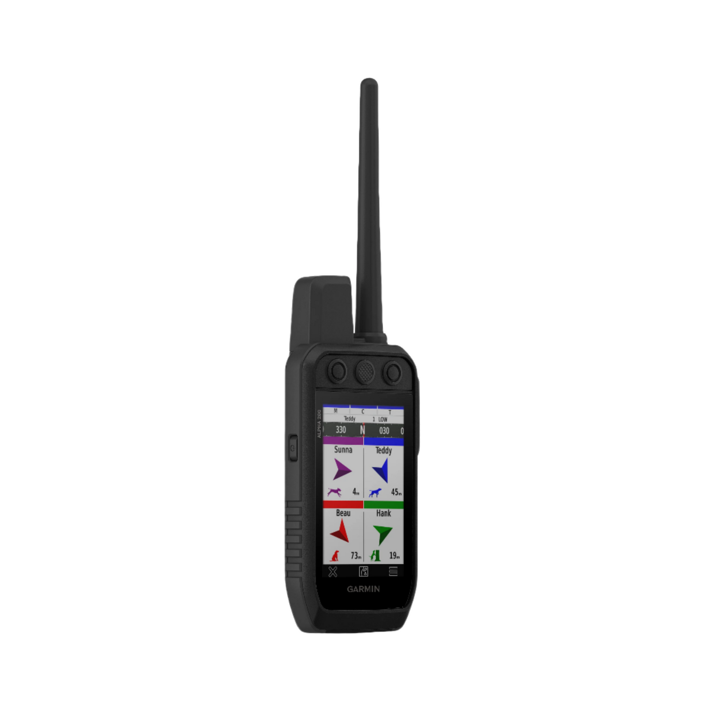
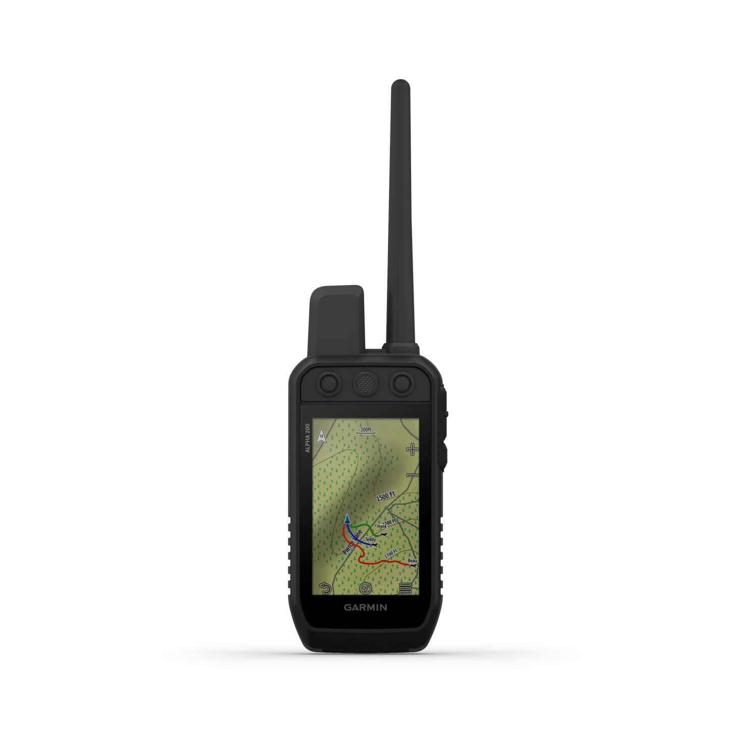
TRACK YOUR PACK
Monitor up to 20 dogs from up to 9 miles (depending on dog device) with a 2.5-second update rate. Pair with T or TT tracking and training collars (each sold separately or as a bundle).
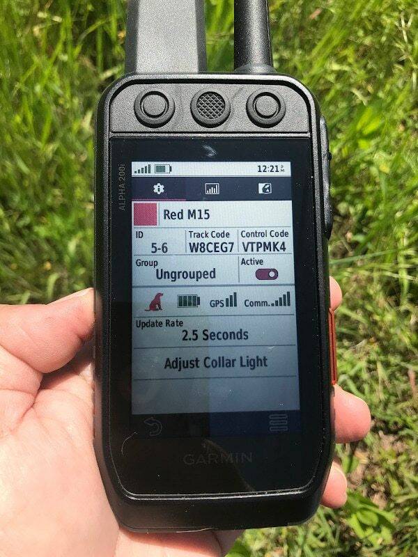
DOG LIST/GROUP MANAGEMENT
Keep inactive dogs in your dog list, and manage active groups so you don’t have to add and remove dogs for every hunt.
PUBLIC LAND BOUNDARIES
Optional display of public land boundaries on topographical maps helps you know that you’re venturing where you’re supposed to be.
HUNT METRICS
See each dog’s daily hunting patterns, distance, and speed so you can monitor performance and help prevent overheating. Pair with your TT™ 15 tracking and training collars.
SIX-BUTTON DESIGN
18 LEVELS OF STIMULATION
Momentary and continuous stimulation options let you customize training for each dog when used with a compatible training enabled collar.
TONE/VIBRATION
When paired with your tracking and training collars, you can issue different levels of audible tone or vibration commands for quick adjustments to individual dogs.
GARMIN EXPLORE™ APP
Pair with the Garmin Explore app on your compatible smartphone to see real-time dog tracking information, save collections of dog tracks and replay tracks to see exactly what happened during your hunt.
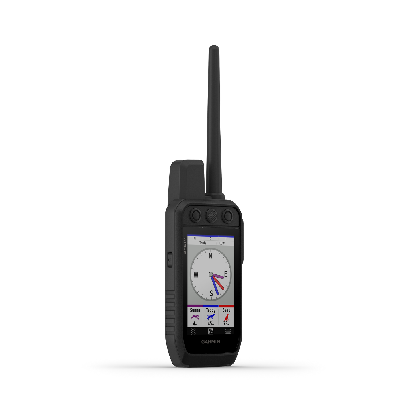
PRO VIEW COMPASS
The pro view compass mode gives you simple, at-a-glance tracking that shows which direction and how far away your dogs are, plus you will see when a dog is “Treed” or “OnPoint.”
MULTI-GNSS SUPPORT
Access multiple global navigation satellite systems (GPS and Galileo) to track your pack with greater accuracy than GPS alone.
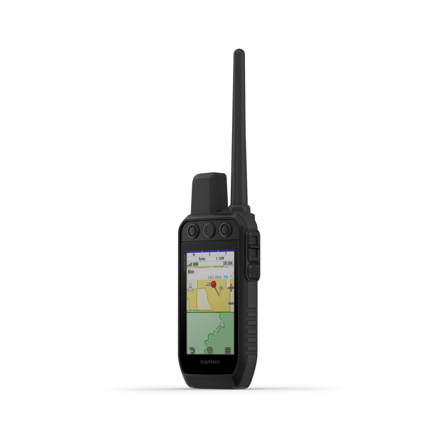
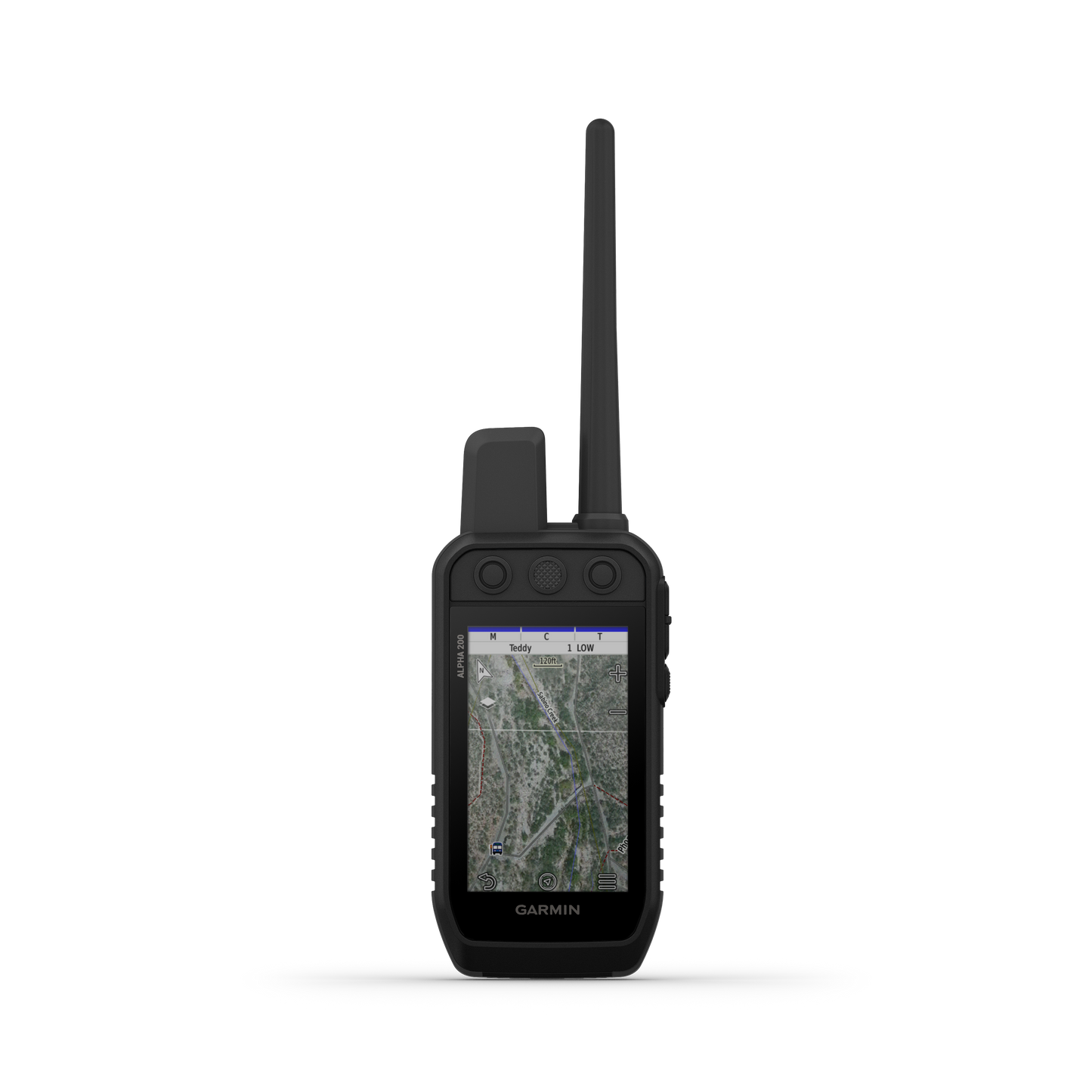
TOPOACTIVE MAPS
Our preloaded TopoActive mapping provides detailed views of terrain contours, topographic elevations, summits, parks, coastlines, rivers, lakes and geographical points.
BIRDSEYE SATELLITE IMAGERY
Download BirdsEye Satellite Imagery directly to the handheld for better-than-real-life views of your route, trailheads, clearings and more (active subscription required).
NAVIGATION SENSORS
A barometric altimeter helps you accurately monitor ascent and descent and see short-term trends in air pressure, and the built-in tilt-compensated three-axis electronic compass keeps your bearing — whether you’re moving or not.
SEE IT ALL
The sunlight-readable 3.5” capacitive touchscreen display makes it easy to see and interact with your maps, dog data and more — even while wearing gloves.
STAY ON THE MOVE
Replaceable battery lasts up to 20 hours, or up to 15 hours with inReach technology enabled.
ADDITIONAL MAPPING
The microSD™ card slot allows you to load more mapping options, such as TOPO U.S. 24K and HuntView Plus maps (each sold separately).
Alpha 200i Handheld Only - In The Box:
- Alpha® 200i handheld with rechargeable lithium-ion battery pack
- Belt clip
- AC adapter
- microUSB cable
- Manual
With OKIE DOG SUPPLY, you get all of the above plus the following:
- Free Shipping
- Free Performance Check
- Free OKIE DOG Lanyard
- Free World-Class Service before, during, and after the sale from knowledgeable people that use the system daily!
Physical & Performance
| Physical dimensions | 2.7 x 6.4 x 1.3” (6.8 x 16.2 x 3.4 cm) *dimensions do not include antenna |
| High-sensitivity receiver | Yes |
| Interface | high-speed USB |
| Display size | 1.8" W x 3.0" H (4.7 x 7.7 cm); 3.5" diag (88.9 mm) |
| Water rating | IPX7 |
| Display resolution | 282 x 470 pixels |
| Weight |
9.9 oz (280 g) with standard antenna and battery |
| Display type | transflective, color TFT touchscreen |
| Battery type | rechargeable lithium-ion (included) |
| Battery life |
up to 20 hours; up to 15 hours with inReach® technology enabled |
Maps & Navigation
| Waypoints/ favorites/ locations |
10000 |
| Track log | 20,000 points, 250 saved gpx tracks, 300 saved fit activities |
| Preloaded maps |
yes (TopoActive) |
| Routes | 250 |
| External memory storage | microSD™ card (not included) |
| Basemap | Yes |
| Memory/History | 16 GB |
| Ability to add maps | Yes |
Features
| BirdsEye | yes, direct to device (no annual subscription required) |
| Send and receive text messages to SMS and email | NO |
| Exchange locations with other inReach device | NO |
| Send route selection to MapShare during trip | NO |
| LiveTrack | yes (with Garmin Explore™) |
| Sun and moon information | Yes |
| Compatible with Garmin Explore™ app | Yes |
| Send waypoints to MapShare during trip | Yes |
| Automatic routing (turn by turn routing on roads) | Yes (with optional mapping for detailed roads) |
| Wireless connectivity |
yes (Wi-Fi®, BLUETOOTH® and ANT+®) |
| Frequency band | MURS |
| Interactive SOS | Yes |
| Touchscreen | Yes |
| Garmin Explore website compatible | Yes |
| Compass | Yes (tilt-compensated 3-axis) |
| Virtual keyboard for custom messaging | Yes |
| Range | Depends on collar attached but up to 9 miles |
| Custom maps compatible | Yes |
| Barometric altimeter | Yes |
| Tracks | up to 20 dogs |
Performing a Master Reset
- Ensure the device is powered off
- Press and hold Scroll Left and Enter simultaneously
- Power on the GPS while continuing to press both previous buttons
- Release the Power button when Garmin appears on the screen
- Release the other buttons once the This will remove all saved user data.....? message appears
- Select Erase
Share